The Calmont-Klettersteig
- start: Bremm/Ediger-Eller
- destination: Bremm/Ediger-Eller
- medium
- 3,54 km
- 1 hour 30 minutes
- 186 m
- 210 m
- 90 m
- 100 / 100
- 60 / 100
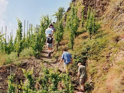
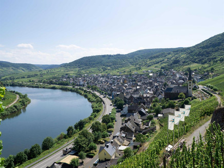
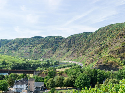
Adventure in the steepest vineyard in Europe. The path leads over ladders past striking rock spurs. Steel ropes give you support when crossing a rocky ridge. Enjoy the magnificent panorama between the towns of Bremm and Ediger-Eller with a view of the Stuben monastery ruins on the narrowest and most beautiful Moselle bend.
The CALMONT Klettersteig was constructed in 2002 as a joint project by the municipalities of Bremm, Ediger-Eller and Neef. The German Alpine Association e.V. secured the route with steel cables, ladders, hoops and pins to ensure a safe ascent and descent.
Hikers need sturdy footwear, no fear of heights and a good level of fitness for hiking and climbing in the CALMONT REGION. There are many rest huts and viewing cabins located along the route. We recommend a hike in the morning or in the early evening on hot summer days. Be sure to have enough water and headwear with you. In an emergency, call 112 giving the location number shown where the monorack railway crosses the via ferrata, which will help rescuers locate you in the event of an emergency.
Impressions
General information
Directions
MAIN ROUTE: The points of entry to the via ferrata are located at the railway bridge in Eller and above the church in Bremm (signposted Klettersteig). The route takes around three hours to complete and also includes some challenging sections, which are nonetheless very well secured. The route goes from Eller over the Galgenlay to the Amphitron viewpoint. You might like to make a short diversion away from the main route and climb up to the cross situated on the summit of the Calmont (with a refuge hut). From the fork, the main route continues slightly downhill returning to Bremm.
RETURN ROUTE OVER THE CALMONT SUMMIT
From the Calmont summit cross, the Calmont high-level route continues past the Roman sanctuary and the famous Vierseenblick (“Four-Lakes-View”) outlook at the Moselle high-altitude refuge hut before returning to Eller.
RETURN ALONG THE MOSELLE RIVER
Either starting at Bremm or Eller, there is also an option of returning to your starting point along the combined cycle route and hiking trail directly on the banks of the Moselle River below the B49 to Ediger-Eller or Bremm. Duration: approx. 30 minutes.
Safety Guidelines
Special care is needed during and after rain or snow and ice. Tread carefully, wear sturdy footwear and avoid overestimating your ability or risky outings.
Be sure to take food and drink with you (especially water). Take into account the weight of your backpack. Be sure to plan in breaks, carry a mobile phone with you (for emergencies) and avoid hiking when there is a risk of a storm.
Equipment
Sturdy footwear and weatherproof clothing are recommended.
Tip
Be sure to go on one of the many guided hikes through the rare flora and fauna in the Calmont region. More information is available at www.calmont-region.de.
Getting there
A61 exit Rheinböllen, B 50, B 421 direction Zell/Mosel, B 49 direction Koblenz;
A48 exit Ulmen, B 259 to Cochem, B 49 direction Trier to Bremm.
Car parks in Bremm and Ediger-Eller will guide you to the via ferrata entrance with signs.
Parking
Parking spaces in Bremm and Ediger-Eller.
Public transit
Train: Regional train from Koblenz and Trier to Ediger-Eller station.
Bus: Bus line 711.
Maps
Wanderkarte Ferienland Cochem
Maßstab 1 : 25.000
7,90 €
Additional Information
Tourist-Information Ferienland Cochem, Endertplatz 1, 56812 Cochem
Tel.: +49 (0) 2671-6004-0, Fax: +49 (0) 2671-6004-44
E-Mail: info@ferienland-cochem.de
Pavings
- Crushed Rock (13%)
- Path (77%)
- Asphalt Coating (10%)
Weather
This tour is presented by: Ferienland Cochem, Author: Tourist-Information Ferienland Cochem


