RuT4 near Ollmuth on the Ruwer river
- start: Ollmuth, car park in front of Ollmuth right behind the cemetery; N 49°40.474 E 6°42.932
- destination: Ollmuth, car park in front of Ollmuth right behind the cemetery; N 49°40.474 E 6°42.932
- medium
- 4,82 km
- 1 hour 31 minutes
- 181 m
- 425 m
- 244 m
- 80 / 100
- 60 / 100
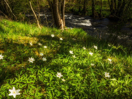
Shadow plays in the green gallery by the stream - on the hike in the valley of the Ruwer & over the heights of the Hochwald, you experience the entire natural diversity of this region.
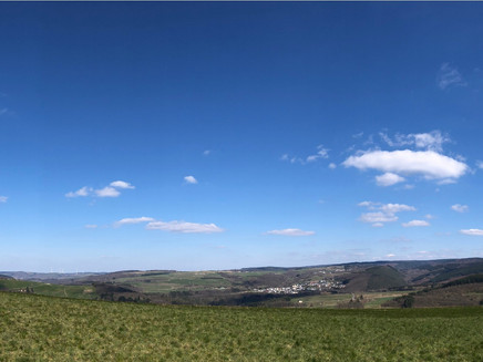
Diverse natural landscapes over 5 km - lined by a gallery of alders, the Ruwer runs through the valley meadows as a green ribbon, the Alkenbach flows in the steep notch valley and on the flower-rich heights you can enjoy the wide view of the Hunsrück plateau.
From the forested valley floor of the Ruwer, the route leads to the flower-rich heights near Ollmuth, which are still largely used for agriculture. Thanks to the extensive cultivation of many plots, however, there are many flower-rich meadows, as well as orchards, which provide varied food, shelter and nesting opportunities for numerous bird species, small mammals and insects.
Impressions
General information
Directions
From the starting point, we walk along the Waschbach down to the Ruwer. A lot has been done here in terms of water protection: the culvert under the road has been rebuilt and the riverbed has been raised so that the aquatic organisms now move unhindered back and forth between the Ruwer and the Geizenburg Waschbach.
Lined by alders, the Ruwer now runs as a green ribbon through the valley meadows, and with luck we spot the dipper, which likes to build its nest here. We reach the Hinzenburg mill and from here we enter the valley of the Alkenbach. Where the valley slopes are too steep for meadows, there are beech and oak trees. The gently sloping headwaters of the Alkenbach are occupied by cattle pastures. Once you reach the flower-rich heights, you have a wide view of the Hunsrück plateau, which is divided by the Ruwer and the steeply incised tributary streams. Shortly before you reach the village, you will recognise it: the belt of orchards that used to surround every village. These orchards not only provide people with healthy fruit, but also offer numerous species of birds, small mammals and insects varied food, shelter and nesting opportunities.
Equipment
Sturdy shoes, comfortable and weather appropriate clothing is recommended.
Tip
The wide view on the high plateau over the mountain ranges of the Hunsrück!
Getting there
From the A1: Exit Reinsfeld in the direction of Kell, via Reinsfeld, Holzerath and Schöndorf to Pluwiger Hammer. There turn left to Ollmuth. Car park before Ollmuth on the right behind the cemetery.
From Trier: Direction Pluwig, at Pluwiger Hammer to Ollmuth. Car park before Ollmuth on the right behind the cemetery.
Parking
Ollmuth, car park in front of Ollmuth on the right behind the cemetery; N 49°40.474 E 6°42.932, free use
Additional Information
The theme trail is funded within the framework of the Ruwer river project through the federal watercourse riparian strip programme with the participation of the state of Rhineland-Palatinate. The aim is to preserve and develop the Ruwer and its tributaries with the floodplains over a stretch of around 186 km as a near-natural watercourse and floodplain landscape in the Saar-Hunsrück Nature Park.
A total of 6 themed hiking trails (Rut1-Rut6) are part of this project and bring the hiker very close to the Ruwer and its use in a very vivid and informative way.
Pavings
- Street (18%)
- Hiking Trail (56%)
- Path (13%)
- Unknown (7%)
- Asphalt Coating (5%)
Weather

This tour is presented by: Mosel. Faszination Urlaub, Author: Touristinformation Ruwer


