Moselsteig Side Trail Mehringer Schweiz
- start: Parking area at the sports facilities Mehring
- destination: Parking area at the sports facilities Mehring
- medium
- 14,06 km
- 5 hours
- 600 m
- 425 m
- 125 m
- 80 / 100
- 60 / 100
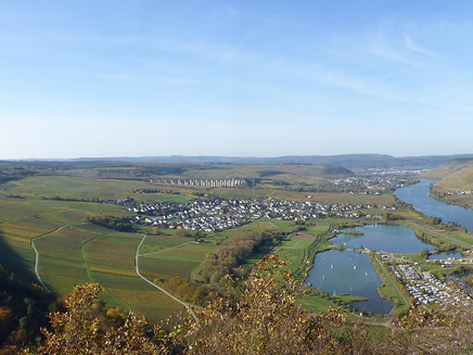
Five lakes: one view.
If you are planning a bigger mountain tour, then the Side Trail Mehringer Schweiz is just right for you. On about 14 km (which, if required, can be divided into two smaller rounds), the challenging round trip with lots of altitude metres (alternatively an ascent can be hiked via a section with passages secured by ropes) leads past impressive viewing points, an establishment offering refreshments and through natural forest sections.In the cultural landscape characterised by viticulture since Roman times, the Roman villa of Mehring is the cultural highlight, which lies directly on the path. The Side Trail Extratour Mehringer Schweiz can be seen as a sporty training session.However, if you allow yourself a little more time while hiking, you will experience the natural course of the path and the magnificent viewing points more intensively. Not only the view from the tower at the Fünfseenblick (view of five lakes) is unique. Also, while hiking, views of the Moselle Valley keep opening up.
The entire round of around 14 km is not particularly long, but the ascent and descent on the nature paths require physical fitness and concentration.
Impressions
General information
Directions
At the starting point of the Side Trail Mehringer Schweiz at the sports field Mehring, you need to decide in which direction you want to tackle this challenging round tour. Hikers who want to experience the climbing passages should hike counter-clockwise as this description suggests.
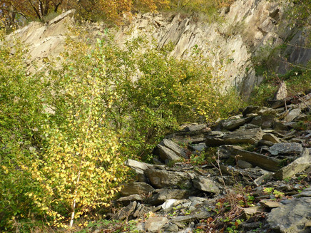
Through the sports field and the sports hall you reach the slope edge covered with dense hedges. From here, the Moselsteig Trail accompanies the Side Trail for a majority of the round up to the Fünfseenblick. Continue uphill on grass paths, at the edge of the housing development.Passing a first viewing point you reach the edge of the forest. In the forest the Side Trail leads steeply uphill for a short section, before it continues on a former forest path through a slope of slate rocks down to the level of the Moselle.
The following section along the edge of the forest is less challenging, even though the path continues uphill. Just a short distance away from the path it the Triolago leisure complex, which in addition to a hotel and restaurant, also offers a summer toboggan run, mini golf and many water sports activities.
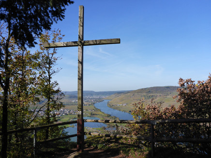
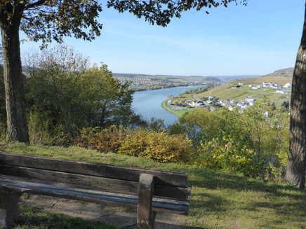
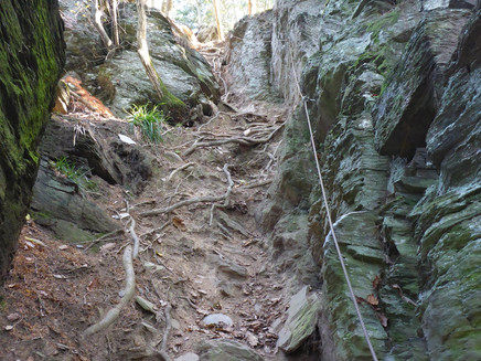
Now the Side Trail becomes challenging! Along the Molesbach, which has impressively dug a channel into the slate rocks, the path leads steeply uphill. After a short stretch you can decide on the climbing variant (sections secured with steel rope) or the "normal" ascent to the summit. The variant without climbing sections (also used by the Moselsteig Trail) is not for the faint of heart. After all, 150 altitude metres need to be overcome over a short stretch. At the summit on the Kumer Knüppchen, both variants meet up again. The ascent was certainly worthwhile! Seating and a lounger invite you to enjoy the grandiose Moselle panorama a little longer.
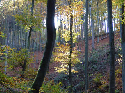
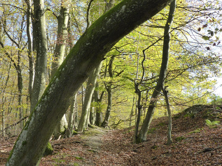
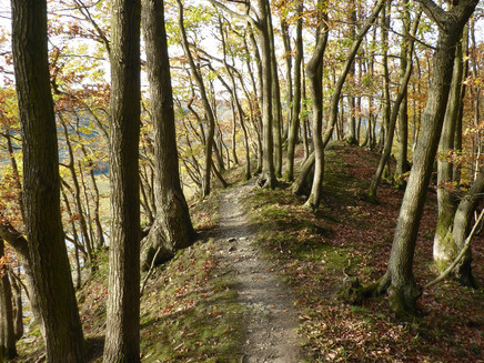
The following section leads over narrow paths, stairs and steps steeply downhill into the steep slope of the Mehringer Schweiz. When reaching the forest path, the Side Trail remains at the same height for a short stretch. The path crosses the MTP trail park track. After a short climb through the coniferous forest, you reach a higher forest path which guides Side Trail and Moselsteig Trail hikers through the wooded steep slope. That this path leads steadily uphill, is hardly noticeable on this varied route. After crossing the county road (the parking area can also be used as the start/end point for the Side Trail) you follow the forest path. The subsequent path at the edge of the forest with its ancient trees is even more beautiful. Here you reach the highest point of the Side Trail Mehringer Schweiz. The path leads through the high forest dominated by large beech trees to a forest path, which reaches the Fünfseenblick viewing tower after a short ascent.
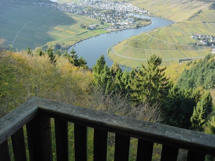
The view from the approximately 20 m high tower should not be missed, even if you need to climb up 105 stairs. In addition to the Moselle "lakes" the view across the vineyards and forested areas right to the mountain tops of the Eifel is impressive.
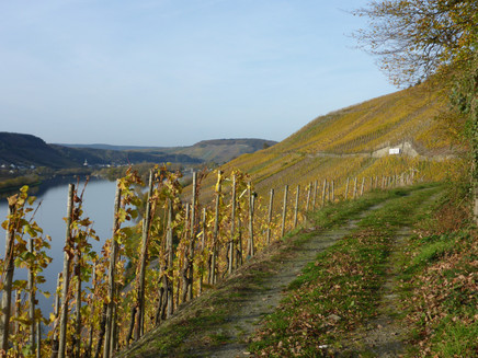
From now on the path only follows the Side Trail markings, as the Moselsteig Trail remains on the same height, whereas the Side Trail leads steeply downhill on a path directly at the foot of the tower. In the forest, you continue to hike steeply downhill. Only after crossing a steep gully, does the path remain at a constant height. Over a rocky path you finally reach the vineyards. The Side Trail uses the path between the forest and the vineyards. This allows you to enjoy the view of the Moselle over a longer stretch.
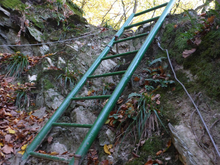
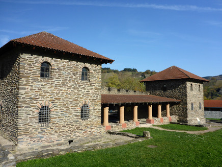
The narrow paths in a former quarry are again somewhat more challenging (in parts also secured with ropes and an iron ladder), but also not less impressive. Here again, some altitude needs to be overcome. The last section back to Mehring leads through the vineyards (past the water treading pool and rest stops). A loop at the outskirts of the village leads to the reconstructed Roman villa (Villa rustica), which is the cultural highlight and wonderful end to an exciting hike.
Safety Guidelines
In wet weather the climbing trail variant should not be taken.
Equipment
The Side Trail should only be hiked on with suitable (sturdy) shoes/hiking boots. For the steel cables in the rope secured sections gloves can be useful.
Tip
The Side Trail mostly leads through forest and the shade of the steep Moselle hills. Therefore, the hike is also suitable for a hike on warm summer days, despite the great differences in altitude that needs to be overcome. Then one should consider a hike in a clockwise direction. At the end of the tour a stop at Triolago is ideal. The climbing passage at the Kumer Knüppchen, however, is recommended in the opposite direction (ascent). From the summit cross, simply follow the Moselsteig Trail signposting.
Getting there
The Mehring sports facilities can be reached from the B53. When you arrive in Mehring switch to the other side of the Moselle. Opposite the signposting of the Roman Villa is the starting point at the sports facilities.
From the motorway A1 take the exit Mehring, then follow the K 85 to Mehring. The parking lot at the sports complex is located just behind the entrance to the village.
Parking
The parking lot at the sports complex offers large parking areas.
Public transit
Take bus no. 220 every hour from Trier to Mehring - exit "Brückenstraße"!
From there it is approx. 400 m to the Mehring sports facility and the start/finish of the hike.
Further information on the detailed timetable can be found at: www.vrt-info.de
or go directly to the VRT timetable page and enter bus route 220 in the mask: https: //www.vrt-info.de/fahrplanauskunft/XSLT_TRIP_REQUEST2?language=de&itdLPxx_contractor=vrt
Literature
Literature (only available in German):
"Seitensprünge" Band 1 - 10 Premium-Rundwanderungen von Trier bis Bernkastel-Kues von ideemedia
Authors: Ulrike Poller, Wolfgang Todt, Publisher: ideemedia, 114 pages, Format: 11,0 x 16,4 cm, ISBN: 978-3-942779-59-3, 12,95 €
Maps
Leisure Map Moselsteig Trail – Map 2: Trier - Zell (Moselle) (Stages 5 - 14), ISBN: 978-3-89637-420-2
Additional Information
Mosellandtouristik GmbH
Kordelweg 1, 54470 Bernkastel-Kues; Phone: +49 (6531) / 97330
Tourist information office Römische Weinstraße
Brückenstr. 46, 54338 Schweich; Phone: +49 (6502) / 93380
Weather
This tour is presented by: Verein Römische Weinstraße e.V., Author: Mosellandtouristik GmbH
